Cotswold Life January
Each month the team at Gloucestershire Archives delve into our diverse collections and put together a piece that appears in Cotswold Life magazine. Articles often include - Photograph of the Month, Spotlight on Maps, Documents of the Month and Gloucestershire Character.
This Spotlight on Maps article was written by John Putley and appeared in the Janaury 2022 issue.
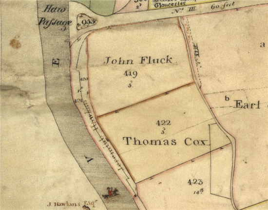
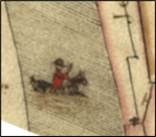
Among the most interesting maps held by Gloucestershire Archives are the county inclosure maps. Although some lands, chiefly around villages, had been inclosed much earlier, most of the Open Field land in Gloucestershire, as well as many commons and wastes, was inclosed between 1750 to 1850 by awards following Acts of Parliament. Although it’s often thought that every parish had an Inclosure Award, this isn’t so and of the over 300 ancient parishes in Gloucestershire, only about 200 were subject to an Inclosure Act. Most consist of a map with award and show the land distribution after the enclosure. The maps are usually well drawn and often show historical curiosities – as this 1815 inclosure map for Deerhurst and Leigh does in the shape of a red-coated man on horseback in the middle of the River Severn. This is Jeremiah Hawkins, who owned land on both sides of the river, but refused to pay to use the ferry at the nearby Haw passage and always forded the river on horseback. Local legend says that he made his servants do the same and at least one drowned!