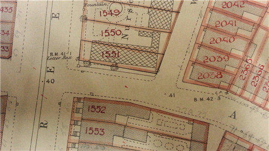
BM?
Have you ever looked at an old map and wondered what BM means? At our recent drop in session where we were using historic maps to inspire ideas and memories, lots of visitors wondered what the BM meant. It appeared very often on the old maps we were looking at and was usually followed by some numbers.
PH appeared quite a lot too!! (Public House just in case you're wondering).
All can be revealed - BM stands for Bench Mark. And, of course now you are wondering what is one of those?
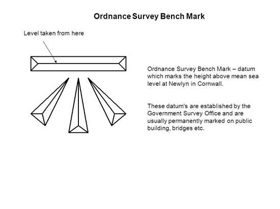
A Bench Mark is a surveyor's mark cut into a wall, pillar, bridge or building and according to Ordnance Survey they are used as a reference point in measuring height above sea level. If the exact height of one BM is known, the exact height of the next can be found by measuring the difference in heights, through a process of spirit levelling.
They are most often found on the corner of a street and usually placed about a quarter of a mile apart. Or at least they used to be. Lots no longer exist because buildings and walls have been demolished or the marks have eroded.
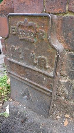
This bench mark, situated near the Archives, is according to our Relief Site Manager, Henry, quite unusual because it's cast iron. We wondered if it had something to do with the foundry that used to be on Foundry Street. (On later maps Foundry Street no longer exists and instead Sweetbriar Street has been extended.)
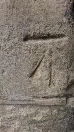
This bench mark is more usual and is carved into the wall about half a metre off the ground. Very handy for getting a crick in your neck if you are keen to spot one.
If you would like to find out more about bench marks visit www.ordnancesurvey.co.uk/benchmarks/benchmarks
Or to look at the benchmark database visit http://www.bench-marks.org.uk/