We all map together
Using Old Maps to Bring Together the Residents of Kingsholm, Gloucester
On Tuesday 5 September, 2017, as part of the Gloucester History Festival, Kim Kenny (For the Record Project Officer), and Sally Middleton (Community Heritage Development Officer), held a drop-in event for locals at Roots Community Café, in Alvin Street. We had over 40 attendees!
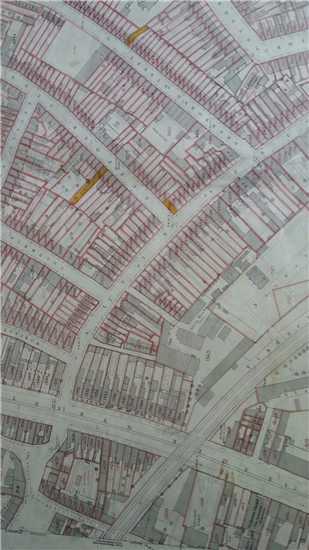
We used Victorian and inter-war maps of the neighbourhood to illustrate how Kingsholm has changed over the last century and a half. The maps helped participants to pinpoint landmarks that they wanted to see included in a mural of the area, to be painted on a boundary wall at the Heritage Hub, by artist Imogen Harvey-Lewis. Lots of suggestions were made to Imogen who was present at the event, and who spent time chatting to people young and old.
Participants delighted in spotting their houses on the maps, and finding the location of the (now demolished) Vinegar Works, Iron Foundry, various plant nurseries and orchards, the Workhouse, the Horton Road Lunatic Asylum, and the City Sanitary Laundry.
One older man told us how his grandmother had worked at the Vinegar Works (now the site of Gloucester Rugby), and how he had accompanied her once upon a time on a works outing to the seaside when he was a toddler.
The OS maps were supplemented by Know Your Place maps, digitally overlaid one on top of the other on a laptop, clearly showing what existed in Kingsholm prior to the late Victorian building boom of owner-occupied residential red-brick terraces. Why not take a look yourself at www.kypwest.org.uk ?
There was a real buzz at this busy event, with neighbour chatting to neighbour, new introductions made and groups of people reminiscing about where they live. The maps helped bring a small part of the community together for a couple of hours, and its legacy will be the new painted mural at the Heritage Hub.


Visit Know Your Place - www.kypwest.org.uk